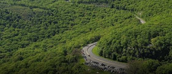
About 20 miles on the western side of Port Angeles and in the vicinity of the Olympic National Park lies the storm king trail, a well-known hiking path among tourists and locals.
The storm king trail will enable you to get the best of both worlds as you can begin by exploring the Olympic National Park and then embark on the hiking trail to take in some breathtaking views from Mount Storm King.
However, before heading there, here is some important information on the hiking trail to help you ensure you go well prepared and know what to expect.
History and Geology
Starting close to the Ranger Station, the track to a top first continues the route towards Marymere Falls before diverging to the northern end after a couple of miles. The first three kilometers of the hike are on a well-maintained track. However, the final part of the journey includes going through rough terrain.
According to Klallum tribal tradition, Lake Sutherland and Crescent were formed when Tsulh-mut was split in two when Mountain Storm King became enraged by battling tribes at its foot and ripped a rock off its top and threw it on the fighters, slaughtering everyone.
About The Hiking Trail
The 6.6-kilometer-long Storm King Trail is situated close to Port Angeles, WA. It might not be the best choice for inexperienced hikers because the trail is difficult. An average hiker will need more than three hours to finish the trail. Therefore, you should come prepared with some food and water bottles.
The route is a very well-liked spot for hiking since it provides some breathtaking natural vistas and is conveniently located inside the boundaries of a park. Therefore, you may run across other hikers while out on your hike.
The months of April to October are ideal for hiking this trek since the weather is perfect. It is best not to take the hike during months other than April to October as the weather is bad and it might become dangerous. If you want a hiking experience with your dog, this might not be the trail for you since dogs are not allowed on it.
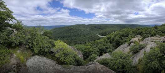
You will reach a large boulder with a sign leaning on it, marking the route uphill by a 180 ° turn within a little distance of hiking. This should put you off of Storm King. We recommend keeping your eyes out for scenery as you climb since there will be amazing views of the lakes and the mountains hidden among the crevices of the trail.
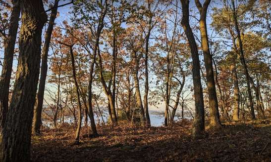
Several observation locations provide a glimpse of the sparkling water of Crescent and Barnes Creek valley. After around 1.3 miles, you will reach a hill with spectacular views of Juan de Fuca and the waters of Crescent. The maintained trail comes to an end here.
The track continues if you wish to, although it gradually gets tougher. Therefore do not push yourself and turn back if you even have the slightest doubt that you won’t be able to complete it.
Once you reach the renowned rope stretch of the path, get ready for some intense workout. At this point, you will have to utilize six ropes to scale the structure. While challenging, the experience will be unique and offer the best adrenaline rush.
The first rope is easier to climb since you have a firm grasp on the rocks. The latter five can be a little more challenging because of how unstable the terrain is due to all the little stones. It can be challenging to reach the summit if you are terrified of heights since this trail involves a lot of rock climbing and heart-stopping views of the lake that might scare you a little.
However, if you succeed in reaching the summit, you will have gotten out of your comfort zone and achieved something you never thought of achieving, which can be a great feeling. You will also get to experience some of the most stunning scenery.
Things to Remember While Hiking On the Storm King Trail
Even though hiking is one of the best things for your physical and mental health, it can quickly become dangerous if you do not follow a set of rules and safety precautions. Here is a list of safety precautions and things you must remember before going on the Storm King Trail hike.
- Bring along a pair of gym gloves to avoid getting rope burns while climbing the ropes
- Check the weather forecast before heading on the hike to ensure you wear appropriate clothing. It can get chilly as you reach the top, so we recommend carrying a jacket with you
- Bring beer canisters along if you plan on camping or having a little picnic while on the hike since unattended food can attract beers
- Let loved ones know you are taking a hike so they can call emergency help if you do not return within the expected hours
- Always bring along essentials such as rain gear, map, flashlight, compass, knife, matches, extra food/water, and nylon cord
How to Get There?
To get to the Storm King Trail, you must travel 20 miles along the western side via Highway 101 through Port Angeles. Turn right into a sizable parking lot labeled with Marymere Waterfall or Lake Crescent after you approach milepost 228.
To reach the Ranger Station, which is located on Crescent’s shoreline, drive another 0.2 kilometers. From there, you can begin your trail.
The parking area at Mount Storm King can be quite full since the location is quite popular. However, compared to other hiking locations, the parking is sizeable. We recommend arriving early to be on the safe side and ensure you get a parking spot.
Wrapping Up
If you find yourself in the Washington region, a hike up the Storm King Trail is highly recommended, especially if you want a challenge. The trek will allow you to unwind and connect with nature. However, we recommend going fully prepared and taking all necessary steps to guarantee a safe return and a wonderful experience.